New Zealand’s Far North probably isn’t what you first think of when you think about the country – i didn’t even know what this region was until it was recommended to us by Clay’s coworkers a few weeks ago! We were told it was a super remote area with beautiful scenery and a beach that was considered an official highway, which was enough for us to decide to book a weekend there. it ended up being such a fun destination, one that I definitely recommend checking out when exploring New zealand’s north island.
region overview

The map to the left (from kiddle) illustrates the area of new zealand’s north island that is considered the “far north”. the region consists of nearly 6700 sq. km / 2600 sq. miles and As of June 2023, the population of this area was 74,700 (so pretty sparsely populated!).
getting there
We roadtripped to the far north from Auckland, which was about a 5 hour drive to where we were staying. the roads are pretty windy and rural, but the scenery is gorgeous and complete with mountains, rolling green hills, farm land, and plenty of animals. We stopped in Whangārei for lunch on the way up and ate at cheeky chooks – their korean fried chicken was my fav thing I ate last week (as seen in week in my life, part two!).
stay
Because the area is so rural, the lodging options are pretty limited in new zealand’s far north. We lucked out and were able to book a house in Pukenui, which is one of the most northern towns that even has lodging options. it ended up being the perfect location for what we were looking to do and see. our house was about 15 minutes from a public access point to the ninety mile beach, 45 minutes from Cape Reinga, and 5 minutes from a cafe/restaurant. it was very affordable, the host was super friendly, and it was perfect for the two of us, but sleeps up to 5. if you’re interested in booking the same place, you can do so here!
play
There is so much to do and see in the far north! i’ve outlined all of the activities and attractions of our weekend below.
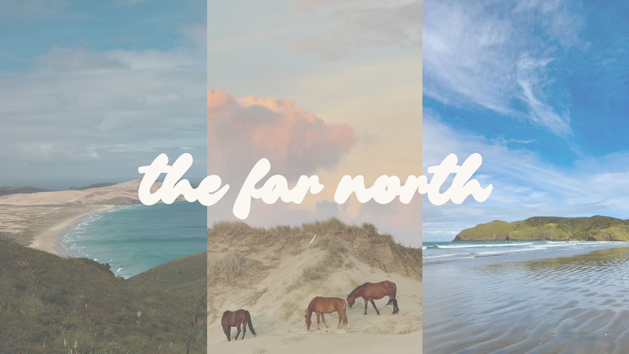
90 mile beach
This beach stretches from Ahipara to Scott point along the western coast of the northern tip of the country. The name is a bit misleading though as this beach is actually only 55 miles long, but it’s still an impressively long stretch of sand. the back story: European settlers named it the 90 mile beach because they knew their horses could walk 30 miles a day and it took them 3 days to walk the entirety of the beach, so of course that meant the beach was 90 miles. little did they know, horses aren’t as efficient walking on sand as they are on grass or other surfaces.
The 90 mile beach is recognized by New Zealand as an official highway, so we decided to use it as such! we rented a 4WD car for the weekend specifically for this purpose, and it was a ton of fun. most of the beach is super easy to drive on, but there are some patches that have shallow streams. We entered the beach from the Hukatere ramp and drove all the way to the Te Paki giant sand dunes, where we had to follow a stream to get back to a road. There are not many (if any) public access points between these two spots, so make sure you have a plan for where you will exit. Also, definitely take the tides into consideration. Driving on the beach at low tide is definitely a better experience than high tide.
We also spent both friday and saturday night on the beach to watch the sunset. we even saw wild horses hanging out on the sand dunes one night! definitely a magical experience.


Te paki giant sand dunes
This is exactly what it sounds like – huge sand dunes! there are pretty big sand dunes along the entire 90 mile beach, but these were substantially larger. We didn’t have a chance to do this, but it is apparently a lot of fun to ride boogie boards down them.

Cape Reinga
Cape reinga is the most northern point of new Zealand and where the Pacific ocean and tasman sea meet. There are a few hiking trails around here, but we just walked down the paved path to the lighthouse. the views of the greenery, cliffs, and ocean were stunning!


Tapotupotu Bay
This super remote bay has unbelievable white sand beaches and icy blue water. to reach this area, you’ll need to drive at least 20 minutes or so downhill on gravel, so make sure you have a car that is capable of doing so. there was hardly anyone here and the scenery was gorgeous.
Spirits Bay
similar to tapotupotu bay, spirits bay has another white sand beach, but the water here is much more clear than icy blue. the bay was enclosed by green hills, one of which had several horses hanging around on it. also similar to tapotupotu bay – getting here requires a decent drive on gravel roads, so make sure you are prepared to drive on them.
Karikari peninsula
after we checked out of our house in pukenui, we headed to the karikari peninsula. this was a beautiful area with a ton of farm land, several beaches, and even a working vineyard. We spent a bit of time at matai bay before heading back to auckland, but we would have stayed longer / explored more had the weather been nicer while we were there.


eats and drinks
finding a restaurant or cafe can be a bit difficult in new zealand’s far north, especially in the more remote areas. we brought plenty of snacks because we knew this going into the weekend, and it was definitely the right move.
in pukenui, there is one main restaurant called pukenui pacific that has good food and a beachy bar atmosphere. There is also a small cafe down the street from the restaurant called the container cafe which had good pies (we had the breakfast pie) and real fruit ice cream. if you’re in the far north, you’ll see several places offering real fruit ice cream, and trying it is a must! it’s different than normal ice cream in that they take an ice cream base and mix in whatever fruit you choose. so good!
on the karikari peninsula, we stopped by salty brew for coffee and a snack. it’s basically a little coffee shop off of the side of someone’s house, but it’s decorated really well and the coffee / lemon bar was great!


questions or comments?
let me know below!
Leave a Reply